This project with Microsoft has really opened my world to the world of user interface design. I find it interesting because of the notion that IDEAS are more important than the actual IMPLEMENTATION of real or virtual products. I think this is the first time, where its been drilled in my head where the actual mapping of user experiences are actually more important than just the inherent "coolness" or excellence of the product (i.e. no matter how awesome/beautiful/technologically savvy your product is, it still has to be used by a human being and that is what matters the most,duh.) 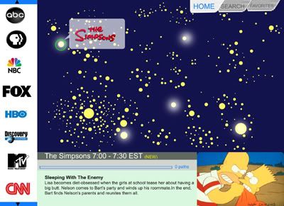
Here is the current iteration of the main menu for an interface. The metaphor for
exploration is looking at a "galaxy" of stars. This leads you to a network of related programming, hopefully clusters exist that link certain types of genres. Jon of course,being the math dork that he is, told me that this system is actually sort of mathematically impossible. The mapping cannot be one to one. I think for now I am content with having multiple stars being shown?
So one scrolls at this "galaxy" of stars to find different types of shows and explore new possibilities. It is essentially a histogram of all shows currently being viewed and the user can make his/her choices accordingly, depending on how nonconformist or conformist he/she wants to be.
A lot of talk has actually been built around these new "maps. For instance there is
Google Maps, then there's Google Earth, there's a number of really great API's for Yahoo Maps . These API's enable people to increase functionality of a certain product. For instance someone has used Google Map to show crime rates in Chicago, by geographic area. Similarly Yahoo Maps has its vast array of applications too.
An article in Wired magazine spells it out pretty nicely.:
"How did we get here? This technology used to be top-secret government stuff. Then, in the 1980s, McDonald's dumped thousands into buying satellite images and developing software called Quintillion, which predicted the growth of cities and school districts. Ever notice there's always a McDonald's where you'd expect one? The company looked down from the heavens and dropped new franchises wherever it saw the right combination of kids, interstates, and suburbs, using one of the first geographic information systems for business analysis."
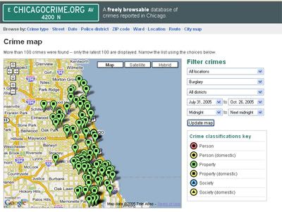
Mapping of real time crimes occuring by type of crime, and geographic area at Chicagocrime.org using the google map interface
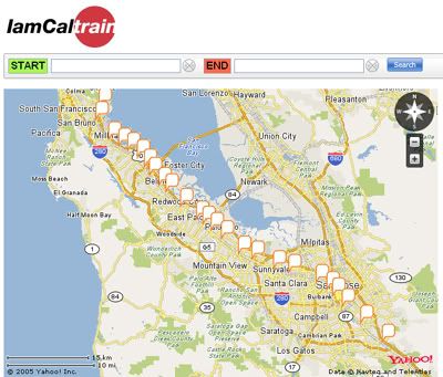
Real Time Caltrain Schedule
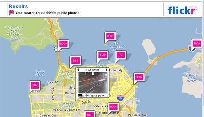
Flickr Photos by City
I'm excited to see where this will go.